Accurate And Advanced Solutions In Surveying & Mapping
At Acurise Geographical Mapping LLC, we deliver cutting-edge geospatial solutions that help businesses, governments, and developers visualize, analyze, and act with confidence.
ABOUT OUR COMPANY
Precision & Cost-Effective Geospatial Intelligence for the Built World
At Acurise Geographical Mapping LLC, we are committed to delivering precision-driven geospatial solutions that empower smarter planning and informed decision-making. With a strong focus on accuracy, innovation, and reliability, we provide high-precision surveying, mapping, and 3D spatial data that powers smarter decisions across the UAE, MENA, and beyond.
Worldwide services
Our expertise knows no borders, delivering accurate mapping and survey data for international projects
Best company award winner
Honored as the Best Company award winner for pioneering advanced GIS and 2D/3D modeling technologies
QUALITY SERVICES
Providing all kind of Surveying & Mapping
Land Survey
Authoritative boundary, topographic, and cadastral surveys that anchor every planning, design, and development decision.
Explore more
Building Construction Surveys
Setting-out, monitoring, and as-built surveys that keep construction aligned with design intent and regulatory compliance.
Explore more
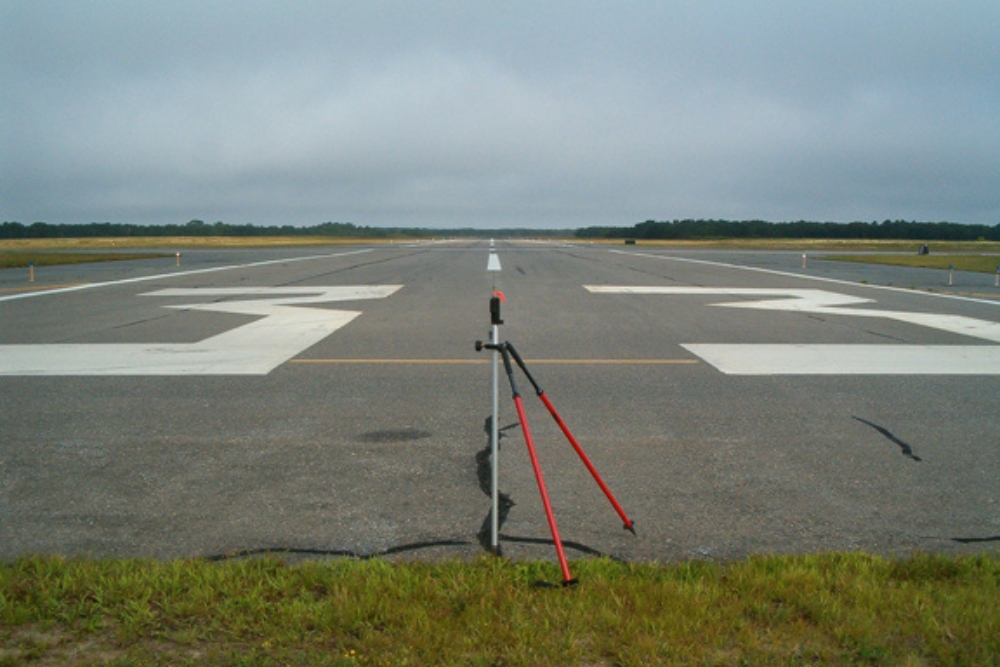
Aeronautical surveys
Obstacle, terrain, and aerodrome mapping calibrated to ICAO standards for aviation safety and airspace planning.
Explore more
Aerial Drone Mapping
UAV-based photogrammetry and Ortho mosaic mapping that delivers high-resolution terrain models in a fraction of traditional timelines.
Explore more
Mobile Mapping
Vehicle-mounted sensor platforms that capture entire road corridors, utility networks, and urban environments at survey-grade accuracy — at driving speed.
Explore more
Lidar 3D Laser Scanning
Dense, millimeter-accurate point clouds for as-built documentation, BIM integration, heritage preservation, and complex infrastructure analysis.
Explore more
Marine Surveys
Bathymetric, hydrographic, and underwater asset surveys that support safe navigation, dredging, and coastal engineering.
Explore moreOffering Entire Superior Services Solutions
FAQ'S
Learn more about our project workflow
We combine advanced geospatial technology with a rigorous processing workflow to deliver precise 2D and 3D solutions. Our end-to-end approach guarantees technical excellence and reliable data delivery for your strategic goals
Project Planning
Our project planning phase defines clear objectives and technical specifications to ensure seamless execution. We prioritize resource allocation and risk management to deliver high-precision geospatial solutions on time
1. Scope and Site Intelligence
We begin with your objectives, regulatory environment, and end-use of the data. From that, we design the optimal sensor mix and capture plan.
2. Capture and Quality Control
Our crews execute the survey using calibrated equipment, redundant ground control, and in-field QA checks to catch issues before demobilization.
3. Processing and Modelling
Raw observations are processed through industry-leading software pipelines and reviewed against project tolerances before any deliverable is signed off.
4. Delivery and Support
You receive documented, audit-ready deliverables — point clouds, Ortho mosaics, DTMs, CAD drawings, GIS layers, BIM models — supported by post-delivery clarification and revision cycles.
Let's talk about what you're building
Whether you're planning a tower in Dubai, a port expansion across the Gulf, or a master-planned community anywhere in MENA, Acurise is ready to deliver the geospatial foundation your project needs.
